Amid the heavy rains that have fallen over Rio Grande do Sul in recent weeks, a tornado hit the northwest of the state on Tuesday night (7/28). The phenomenon was recorded in the municipalities of Giruá, Sete de Setembro and Senador Salgado Filho. At least seven people were injured.
Tornado hits cities in Rio Grande do Sul
Amid the heavy rains that have fallen over Rio Grande do Sul in recent weeks, a tornado hit the northwest of the state on Tuesday night (7/28). The phenomenon was recorded in the municipalities of Giruá, Sete de...

In Giruá, the city hall reported that some homes suffered severe damage, with trees falling and roofs falling apart. In addition to the strong winds, hail was reported in the municipality. On Sete de Setembro, Civil Defense reported that two houses were completely destroyed.
Videos recorded during the tornado show the speed of the phenomenon, which occurred at around 6:25 pm. According to CNN Brasil, the Rio Grande do Sul Civil Defense monitoring system was unable to predict the formation of the tornado. The Monitoring Center issued an orange alert for the region, indicating the potential for a severe storm with hail and gusts of wind, but the lowest radar beam was more than 4.5 km high in the region where the tornado occurred, making it impossible to identify rotation close to the surface that could suggest the occurrence of the phenomenon.
According to MetSul Meteorologia, the tornado was caused by a supercell, the most organized and intense type of storm, characterized by the presence of a rotating updraft (mesocyclone). Unlike common storms, which tend to have a shorter life cycle, a supercell can persist for several hours, moving over great distances while producing severe phenomena. This type of storm is capable of generating torrential rain and hail, with intense electrical activity and destructive gusts of wind. CNN Brasil and O Globo addressed this information.
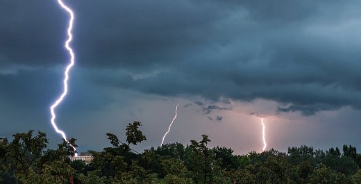
Data from Climatempo show the intensity of electrical activity in the skies of Rio Grande do Sul. Last Tuesday alone (27), the state recorded more than 719 thousand atmospheric electrical discharges, a number that includes both those that occur between the clouds and those that reach the ground (known as “lightning”). g1 gave more information.
The intense rain in recent days has raised river levels in several areas of the state. g1 reported that the Caí, dos Sinos, Paranhana, Gravataí, Jacuí, Taquari and Uruguai rivers were above the flood level this Wednesday (29). More than 300 people were evacuated from their homes near these rivers. Civil Defense warns that the situation should continue to be worrying this Thursday (30), including the possibility of flooding in unmonitored streams and small rivers, in addition to flooding points in urban centers.
At least in the skies, today will be calmer, with the arrival of a mass of dry air that will favor the predominance of stable weather in almost all of RS. But the relief is temporary: on Friday (31), the formation of a new cold front between Argentina and Uruguay will increase cloudiness, with heavy rain expected in the south and southwest of the state.
The tornado in RS was highlighted in the press, with articles in CartaCapital, Correio do Povo, Folha, g1, GZH, ICL Notícias, O Globo and UOL, among others.
Source: ClimaInfo
Next recommended read
This story was originally published by ClimaInfo. Visit the original publication for further details.
Open original publication