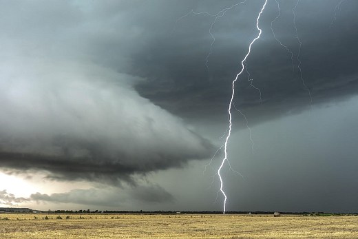
Photo: Freepik
Bomb cyclone forms and threatens to bring storms, hail and winds above 100 km/h; know where
Photo: Freepik An extratropical cyclone with “bomb cyclone” characteristics is expected to form over the ocean in the coming days and cause important changes in weather conditions in several regions of Brazil. The...
An extratropical cyclone with “bomb cyclone” characteristics is expected to form over the ocean in the coming days and cause important changes in weather conditions in several regions of Brazil. The system, which is gaining strength quickly, should favor the occurrence of storms in the South of the country and also influence areas of the Central-West.
Satellite images show the organization of the system, which already this Wednesday (5) causes instability in soybean-producing areas, mainly in the center-south of Mato Grosso do Sul. The forecast indicates that severe weather conditions are expected to continue between Thursday and Friday, with the possibility of hail, intense storms and wind gusts that can exceed 100 km/h.
Even with the arrival of instability, the heat remains strong in Goiás and Mato Grosso, with maximum temperatures exceeding 40°C in some areas. The heat and low humidity scenario increases the risk of fire outbreaks, especially in the drier regions of the Midwest.
At the rear of the system, a cold air mass is expected to advance over the weekend, reaching mainly the south of Mato Grosso do Sul. There is a possibility of frost, with minimum temperatures falling below 5°C to 6°C in some locations.
Despite the passage of the system, the rain should not be very heavy in the Midwest. In the center-south of Mato Grosso do Sul, the expected accumulations are between 30 and 40 millimeters, followed by a period of approximately 10 days of firmer weather, once again favoring field work.
- Stay up to date with the main news about soy: access the Soja Brasil community on WhatsApp!
Bomb cyclone worries South and Southeast regions
On a national scale, the extratropical cyclone is expected to rapidly intensify over the ocean between Wednesday and Thursday, acquiring the characteristics of a bomb cyclone. The phenomenon is expected to cause storms in Rio Grande do Sul, Santa Catarina, Paraná and south of São Paulo.
The highest volumes of rain are expected in Paraná, where rainfall may exceed 100 millimeters in the coming days, potentially affecting agricultural activities and field operations.
Meanwhile, in the North and Northeast, no major changes in the weather pattern are expected over the next 10 days. The exception is Roraima, which can record volumes of between 30 and 40 millimeters of rain between the 11th and 15th of August.
The highlight continues to be the contrast between the extreme heat in the Center-North of the country, with temperatures between 30°C and 35°C, and the arrival of the most intense cold in the south of Mato Grosso do Sul, which can bring a sudden change in meteorological conditions.
The post Bomb cyclone forms and threatens to bring storms, hail and winds above 100 km/h; find out where it first appeared on Canal Rural.
Source: Canal Rural
Next recommended read
This story was originally published by Canal Rural. Visit the original publication for further details.
Open original publication