AI-generated image for Canal Rural
Cyclone causes gale, hail and frost; see regions that will be affected
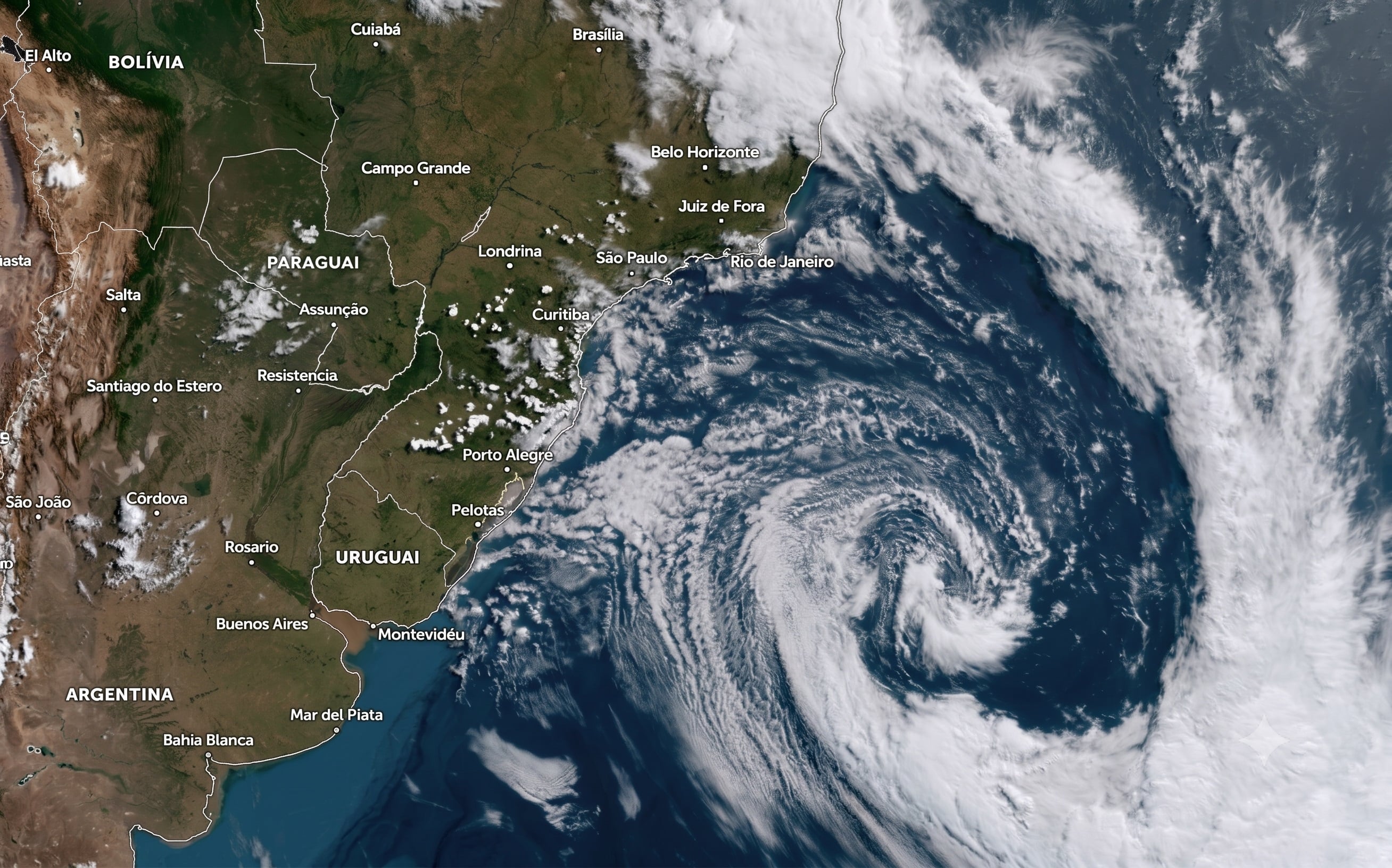
AI-generated image for Canal Rural An extratropical cyclone is expected to form near the coast of the Southern Region between Thursday (20) and Friday (21), causing a sequence of changes in the weather in different areas of the country....
- See first-hand everything about agriculture, livestock, economy and weather forecast: follow Canal Rural on Google News! The effects begin in Rio Grande do Sul and later advance to Santa Catarina, Paraná and part of the Southeast and Center-West.
- Behind the cold front associated with the cyclone, a mass of polar air is also advancing across the continent and is expected to cause frost in the South and even a cold episode in the...
- Cyclone could cause rain of up to 80 mm in Rio Grande do Sul On Thursday, an area of low pressure combined with the advance of the cold front keeps Rio Grande do Sul at risk of heavy rain,...
Editorial reading aid based only on information contained in this story and its identified source.
An extratropical cyclone is expected to form near the coast of the Southern Region between Thursday (20) and Friday (21), causing a sequence of changes in the weather in different areas of the country. According to Climatempo, the system will be associated with heavy rain, storms, the possibility of hail, gusts of wind and a sharp drop in temperatures.
- See first-hand everything about agriculture, livestock, economy and weather forecast: follow Canal Rural on Google News!
The effects begin in Rio Grande do Sul and later advance to Santa Catarina, Paraná and part of the Southeast and Center-West. Behind the cold front associated with the cyclone, a mass of polar air is also advancing across the continent and is expected to cause frost in the South and even a cold episode in the North of the country.
Cyclone could cause rain of up to 80 mm in Rio Grande do Sul
On Thursday, an area of low pressure combined with the advance of the cold front keeps Rio Grande do Sul at risk of heavy rain, storms and hail. The areas of greatest attention are the west, Campanha, central region, south, Metropolitan Region of Porto Alegre, Vales, Serra and North Coast.
Predicted accumulations vary between 10 and 50 millimeters, but could reach 80 millimeters in the west and south of Rio Grande do Sul. It is precisely between Thursday and Friday that the low pressure should evolve into an extratropical cyclone close to the coast.
In Santa Catarina, the rain advances from the west and south and reaches the east and the coast until the end of Thursday. In Paraná, instability mainly affects the west and southwest regions.
Strong winds continue even with cyclone on the high seas
On Friday, the extratropical cyclone is expected to move away to the high seas. This does not mean, however, the end of the impacts.
The increase in the pressure gradient maintains strong winds mainly in the east of Santa Catarina and Paraná. At the same time, cold air advances and reduces temperatures in the three states of the Southern Region.
The most intense instability decreases in Rio Grande do Sul, although it may still rain in the north, east, coast and south of Rio Grande do Sul. There is also a forecast of rain in the south and interior of Santa Catarina and in the south of Paraná.
Polar air drops temperatures and can cause frost
After the passage of the cold front and the cyclone, the mass of cold, dry air gains strength. On Saturday (22), temperatures are expected to drop sharply in the South.
There are conditions for frost in the south of Rio Grande do Sul, especially in Campanha, and also in areas of southern Paraná. The cyclone, at this point, will already be away over the ocean, while the cold front will have advanced towards the Southeast.
São Paulo will have gusts of almost 70 km/h and risk of dust
The effects of the system will also be felt in the Southeast. On Thursday, São Paulo will still be hot and dry, but the approach of the cold front is starting to cause changes in the west of the state.
Between late afternoon and evening, the intensification and change in wind direction can cause dust to rise in the interior of São Paulo, after several days of dry soil and low humidity.
On Friday, the cold front advances and gusts can approach 70 km/h, especially in the center-east of São Paulo. Polar air is also beginning to bring down temperatures in the center-south of the state.
In Rio de Janeiro, the heat still prevails for much of the day, but the rain arrives mainly at night in Costa Verde, south of Rio de Janeiro, the Metropolitan Region and the Mountain Region. The South of Minas and the Triângulo Mineiro will also see an increase in winds.
In the capital of São Paulo, the change will be significant. After a predicted maximum of 32°C on Thursday, thermometers could reach just 21°C on Saturday, when the city will be under the influence of the colder air mass.
Polar air advances through the Midwest and causes cold in the North
In the Central-West, Mato Grosso do Sul will be one of the states most affected by the change. An approaching cold front will bring moderate to heavy rain to areas of the west, southwest, northwest and south on Thursday. On Friday, the polar air mass keeps temperatures significantly lower in the state and also reaches the extreme south and southwest of Mato Grosso and the extreme south of Goiás.
The polar air advances further through the interior of the continent and reaches the North Region. Between Thursday and Friday, Acre and the south of Rondônia will see a change in winds to the south and a drop in temperatures, characterizing an episode of cold weather.
Thus, although the extratropical cyclone has a more direct effect on the South and areas close to the coast, the combination between the system, the cold front and the polar air mass will be responsible for a broad change in the weather pattern, interrupting the period of intense heat in part of central-southern Brazil.
The post Cyclone causes windstorms, hail and frost; see regions that will be affected appeared first in Canal Rural.