The Civil Defense of Rio Grande do Sul issued a warning for storms in the State starting this Thursday (16). The alert is valid until Saturday (18), and the most critical period is between Friday night and Saturday morning, according to the State Civil Defense. There is a risk of storms with gusts of wind and hail in areas of the West, Campanha and South of the State. Civil Defense says there is a risk of tornadoes. ? Access the g1 RS channel on WhatsApp Rain accumulations can reach 150mm - and part of the rain can be concentrated in a short space of time. There is a possibility of wind gusts between 60 and 100 km/h. The Civil Defense alert adds to another, from the National Institute of Meteorology (Inmet), which also published a warning of potential danger for storms valid for Thursday, covering the west and south of Rio Grande do Sul. Weather conditions are expected to worsen further between Friday and Saturday. Therefore, another warning of danger for storms was issued, covering practically the entire State of Rio Grande do Sul, including the Metropolitan Region of Porto Alegre. One of the factors that will contribute to the storms is the Low Level Jet (JBN), a phenomenon commonly called "atmospheric rivers" or "flying rivers". Civil Defense Alert: Find out what to expect each day in RS Cold, heat and hail: after temperatures below 0ºC, RS should have atypical heat of 32°C Influence of El Niño should cause storms and strong winds in RS Southern region may suffer from heavy rains over the weekend Getty Images The Low Level Jet is an intense current of winds that operates in the interior of South America, at altitudes between approximately 1 and 3 km. This system is responsible for transporting hot and humid air from the Amazon towards the Center-South of the continent, providing heat and humidity for the formation and intensification of storms, according to Inmet. "When the JBN interacts with frontal systems coming from the south of the continent, there is an increase in humidity convergence and atmospheric instability, favoring the occurrence of severe storms", says Inmet in a note to BBC News Brasil. "In the episode scheduled to begin on Thursday, JBN is expected to act intensely in the South Region." The National Center for Natural Disaster Monitoring and Alerts (Cemaden) also predicts heavy rains for the southern region of Brazil. "From Thursday onwards, a cold front will pass and this front will remain stationary until probably Monday. Then there will be several consecutive days of rain. The total volumes are relatively important", the general coordinator of Operations and Modeling at Cemaden, Marcelo Seluchi, told BBC News Brasil. He says that the phenomenon of "flying rivers" must have some influence on storms, but that at this time of year — winter — the transport of moisture from the Amazon to the South is lower. "We are in a colder season, a much drier season. So this transport in this season is not as important, although it will have a certain influence." Chile is also expected to be affected by "flying rivers" over the weekend. The company MetSul Meteorologia says that a powerful atmospheric river is advancing across the Pacific Ocean towards South America and is expected to reach Chile this week, bringing extreme rain, storms, intense winds and heavy snowfall in the Andes Mountains. "The atmospheric river should reach category 4 and, at times, category 5, the maximum level of the scale used to classify these water vapor corridors. Systems of this intensity are able to transport enormous volumes of moisture from the tropical regions of the Pacific Ocean to the West coast of South America", states MetSul. The most affected regions should be Coquimbo, Valparaíso, Metropolitana, O'Higgins, Maule, Ñuble and Biobío, according to MetSul. Infographic shows what 'flying rivers' look like Art/BBC Atmospheric rivers "Atmospheric rivers" or "flying rivers" are long, wide columns of water vapor that generally emerge from the tropics and move towards the poles. They carry about 90% of the total water vapor that moves through Earth's mid-latitudes. Scientists attribute some high-intensity storms to "flying rivers," which are becoming more intense, longer, wider and more destructive. According to NASA, they are putting hundreds of millions of people at risk of flooding around the world. Not all atmospheric rivers cause damage, especially if they are of low intensity. And some play an important role in regulating rainfall in certain regions of the world. In South America, for example, "flying rivers" formed by moisture evaporating from the Amazon Rainforest cause rain more than 3,000 km away, reaching southern Brazil, Uruguay, Paraguay and northern Argentina. In these regions, these "flying rivers" are considered vital for agricultural production and the lives of millions of people, and deforestation in the Amazon is seen as a threat to the functioning of the system. An average atmospheric river is about 2,000 kilometers long, 500 kilometers wide, and nearly three kilometers deep—although they are getting wider and longer, some more than 5,000 kilometers long. And yet, they are invisible to the human eye, unlike clouds. "They can be seen at infrared and microwave frequencies," says Brian Kahn, an atmospheric researcher at NASA's Jet Propulsion Laboratory. "That's why satellite analysis can be so useful for observing water vapor and atmospheric rivers around the world." Large, strong atmospheric rivers can move moisture at a discharge rate 15 times that of the Mississippi, the longest river in North America. On average, they have about twice the regular flow of the Amazon, the world's largest river by water discharge volume. Although atmospheric rivers have always existed, scientists say global warming is creating more water vapor. This makes them more intense and capable of dumping large amounts of water onto the land in a short space of time, triggering catastrophic floods and landslides. Studies have shown that global atmospheric water vapor has increased by up to 20% since the 1960s and continues to increase with temperature. A study by the Institute of Geosciences at the University of Potsdam in Germany found that atmospheric river conditions in tropical South America, North Africa, the Middle East and Southeast Asia are lasting longer. And this could mean an increase in the amount of rain that falls with harmful effects on the soil. This is exactly what happened in the Middle East in April 2023, according to another study by Khalifa University in the United Arab Emirates. "Our high-resolution simulations revealed the presence of atmospheric rivers that generated heavy precipitation as they moved at high speeds from northeast Africa to western Iran," the study concluded. Atmospheric rivers in the Amazon When it comes to flying rivers in the Amazon region, moisture often originates in the Amazon Rainforest and takes the form of atmospheric rivers at higher latitudes, scientists say. As they move towards the Andes, the flying rivers face the barrier represented by the mountain ranges and are therefore redirected towards the central-west, southeast and south of Brazil, as well as to the north of Argentina, Uruguay, Paraguay, Colombia, Venezuela, Guyana, French Guiana and Suriname. But the Amazon's humidity isn't the only weather system present there. Moisture generally from flying rivers in Brazil originates in the Amazon Rainforest Getty Images "It's also influenced by the equatorial rain belt with trade winds (the fast winds close to the ground) and the Andes Mountains," says Deniz Bozkurt, a meteorologist at Valparaíso University in Chile who specializes in atmospheric rivers. "These elements together can guide moisture, making it travel south, leading to heavy rain and flooding in other regions," he says. "When these conditions align with favorable conditions, such as the formation of cold fronts in southern latitudes, we can observe 'typical' atmospheric rivers transporting moisture from the Amazon to the southeast and towards the Atlantic, causing significant rainfall", he adds. "These atmospheric rivers can transport large amounts of freshwater from the Amazon basin to other regions of South America and mid-latitudes, and in some cases even reach the coasts of Antarctica and South Africa," says Bozkurt. These rivers in the sky in the region that originate from Amazon moisture under normal circumstances play a key role in balancing temperatures and humidity levels at higher altitudes, such as in southern Brazil, atmospheric scientists say. They say these flying rivers prevent desertification and sustain biodiversity in the region, although they can also sometimes lead to heavy rainfall. But deforestation has represented a significant challenge to the region's climate system and its positive impact on biodiversity, experts warn. The destruction of forests can significantly reduce the amount of water vapor, which forms atmospheric rivers and which, in turn, transport moisture. "And this causes negative climate effects both locally and in other parts of South America." With reporting by Navin Singh Khadka of the BBC World Service.
Civil Defense of Rio Grande do Sul issues warning for storms: what are 'atmospheric rivers', one of the factors in the rain forecast
The Civil Defense of Rio Grande do Sul issued a warning for storms in the State starting this Thursday (16). The alert is valid until Saturday (18), and the most critical period is between Friday night and Saturday morning, according to...
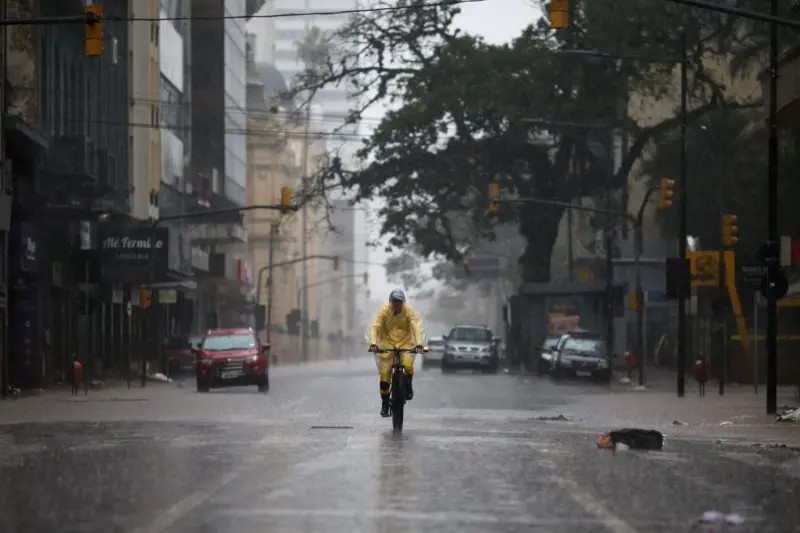
Civil Defense says there is a risk of tornadoes. Access the g1 RS channel on WhatsApp Rain accumulations can reach 150mm - and part of the rain can be concentrated in a short space of time.
- The Civil Defense alert adds to another, from the National Institute of Meteorology (Inmet), which also published a warning of potential danger for storms valid for Thursday, covering the...
- Weather conditions are expected to worsen further between Friday and Saturday.
Editorial reading aid based only on information contained in this story and its identified source.